6. 3D Web Map Client
Note
This is the documentation of the 3D Web Map Client version 1.9.
Starting from version 3.3.0, the 3DCityDB software package comes with a software package called 3DCityDB-Web-Map-Client (in this chapter we simply call it “3D web client”) acting as a web-based front-end for high-performance 3D visualization and interactive exploration of arbitrarily large semantic 3D city models. The 3D web client has been developed based on the Cesium Virtual Globe, which is an open source JavaScript library developed by Analytical Graphics, Inc. (AGI). It utilizes HTML5 and the Web Graphics Library (WebGL) as its core for hardware acceleration and provides cross-platform functionalities like displaying 3D graphic contents on the web without the needs of additional plugins.
While developing the 3D web client, various extensions have been made to the Cesium Virtual Globe in order to facilitate users to view and explore 3D city models conveniently. The major one among those extensions is that the KML/glTF models exported using the Import/Export tool can now be directly visualized along with imagery and terrain layers within a web browser using the 3D web client, which additionally can link the KML/glTF models with table data exported using the Spreadsheet Generator Plugin (SPSHG) and allows querying the thematic data of every city object. With this newly introduced 3D web client, the functionalities of the 3DCityDB now range from high-efficient storage and management of virtual 3D city models according to the CityGML standard up to high-performance visualization and exploration of them on the web.
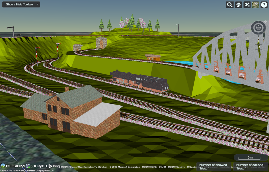
Fig. 6.33 Screenshot showing the example of displaying different CityGML top-level features (building, bridge, tunnel, water, vegetation, transportation etc.) in glTF format in the 3D web client