4.7.2. Reference systems
When setting up an instance of the 3D City Database, a coordinate reference system (CRS) must be chosen for the entire database (cf. Section 1.3). This CRS is used as default reference system for all spatial objects that are created and stored in the database instance (expect implicit geometries) as well as for building spatial indexes and performing spatial functions.
At many places, the Importer/Exporter allows for providing coordinate values associated with a different CRS though, e.g. when defining spatial bounding box filters for the different import and export operations or when defining a target CRS into which coordinate values shall be converted during CityGML/CityJSON exports. To add and manage additional reference systems, the Importer/Exporter provides the Reference systems settings below the Database preferences node.
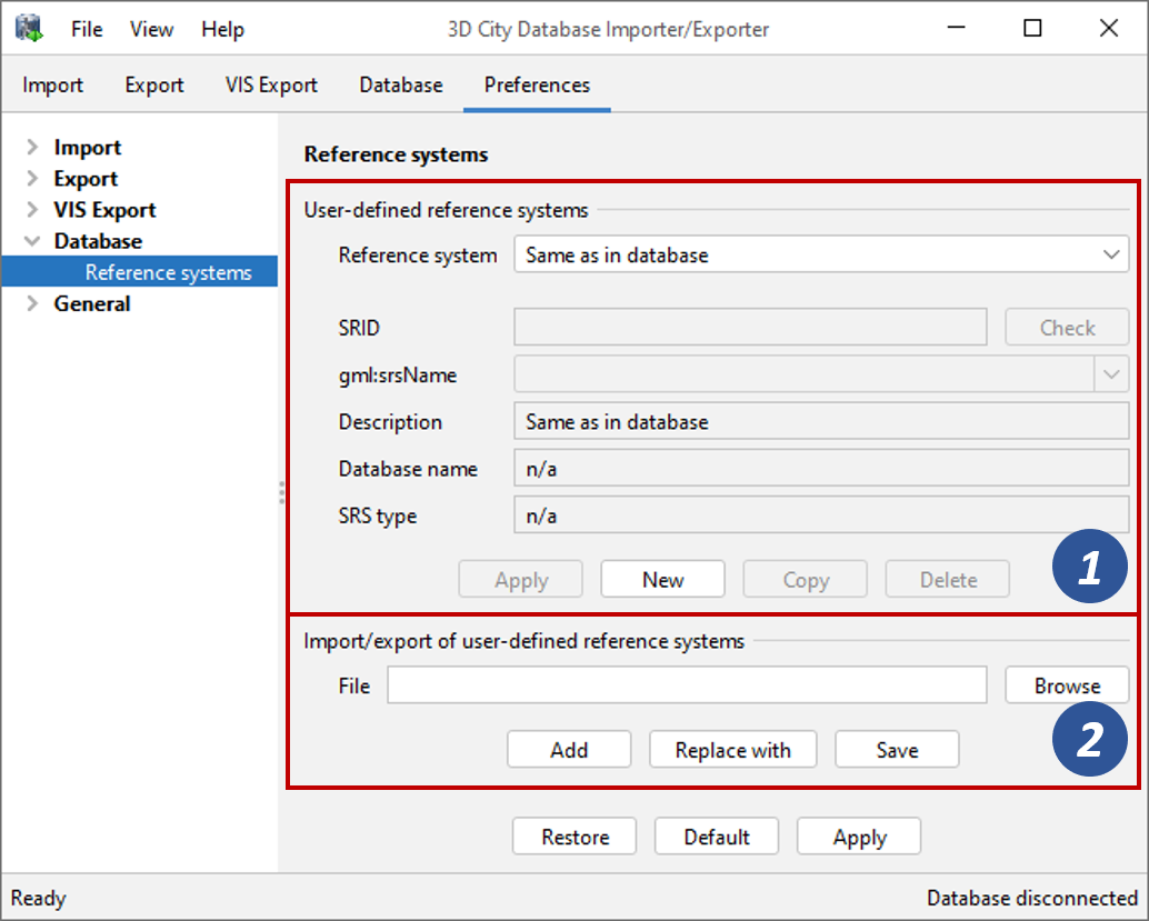
Fig. 4.83 Database preferences – Reference systems.
On top of the dialog [1], a drop-down list allows for choosing a CRS for display and editing from the list of user-defined CRSs. This list contains at minimum one predefined entry called Same as in database that represents the internal CRS of the 3D City Database instance. This entry will always show the SRID and gml:srsName of the currently connected database instance.
Note
The internal CRS cannot be edited in this dialog. If you want to change the internal CRS, then follow the steps in Section 4.3.4.
A new user-defined CRS can be added to this list by clicking the New button. Please provide the database-specific SRID in the corresponding SRID input field of the user dialog and enter the URN encoding of the CRS into the gml:srsName input field (optional). This field also provides a drop-down list of commonly used encoding schemes which can be used as template (such as the OGC encoding scheme). A short, meaningful textual description of the CRS must be provided in the Description field. This description is used as value for the drop-down list at top of the dialog, but also for similar CRS drop-down lists on further tabs of the Importer/Exporter. The new CRS is added to the list of user-defined CRSs upon clicking the Apply button. The following screenshot provides an example.
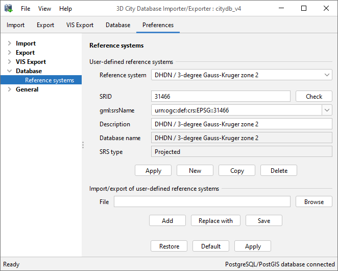
Fig. 4.84 Adding a new CRS to the list of user-defined CRSs.
The Copy button allows for adding further CRSs by copying and editing the information of an already existing one. The currently selected CRS is deleted from the list by clicking the Delete button. The Check button next to the SRID input field facilitates to verify whether the provided SRID is supported by the currently connected 3D City Database instance. After a successful check, the non-editable fields Database name and SRS type will be filled with the corresponding information queried from the 3D City Database instance. If the Importer/Exporter is not connected to a database instance, the Check button is disabled.
The result of the SRID verification may vary between different 3D City Database instances since 1) the list of predefined spatial reference systems differs between different database systems and versions, and 2) both PostgreSQL/PostGIS and Oracle support the definition of user-defined spatial reference systems on the database side (please check the respective database documentation for guidance).
Note
In order to add a user-defined CRS to the Importer/Exporter that is not supported by the underlying PostgreSQL/PostGIS or Oracle database, you need to first register this CRS in your database. As soon as the CRS is available from the database, it can be added to the list of user-defined CRSs in the Importer/Exporter.
Note
You can also create multiple CRS definitions for the same database SRID that only differ in their gml:srsName values. This way, you can easily use different gml:srsName values for different CityGML exports, for example, in case specific target applications require a certain but different syntax for the gml:srsName.
The list of user-defined CRSs is automatically stored in the config file of the Importer/Exporter and loaded upon application start. It can additionally be exported into an extra file (see [2] in Fig. 4.83). This allows for easily sharing user-defined CRSs between different installations of the Importer/Exporter. Please provide a valid filename in the corresponding input field Filename (use the Browse button to open a file selection dialog) and click on Save.
There are two options for importing an external list of CRSs:
Add: the CRSs listed in the external file are added to the current list of CRSs.
Replace: the current list of CRSs is replaced with the entries from the external file.
The Importer/Exporter is shipped with a number of predefined CRSs
organized in subfolders below templates/CoordinateReferenceSystems in
the installation folder. Each CRS definition is stored in its own file
and, thus, can be easily imported and added to the list of user-defined
CRSs. Note that the gml:srsName of the predefined CRSs generally lacks
a height reference system. It should therefore be added
before using this CRS as target reference system for CityGML exports.