2.7.3.9. LandUse Model
The CityGML feature class LandUse and its attributes specified in the UML (cf. Fig. 2.15) diagram are directly mapped the LAND_USE table and its corresponding columns. The relation to table SURFACE_GEOMETRY is established by the foreign keys LODx_MULTI_SURFACE_ID, where 0 ≤ x ≤ 4.
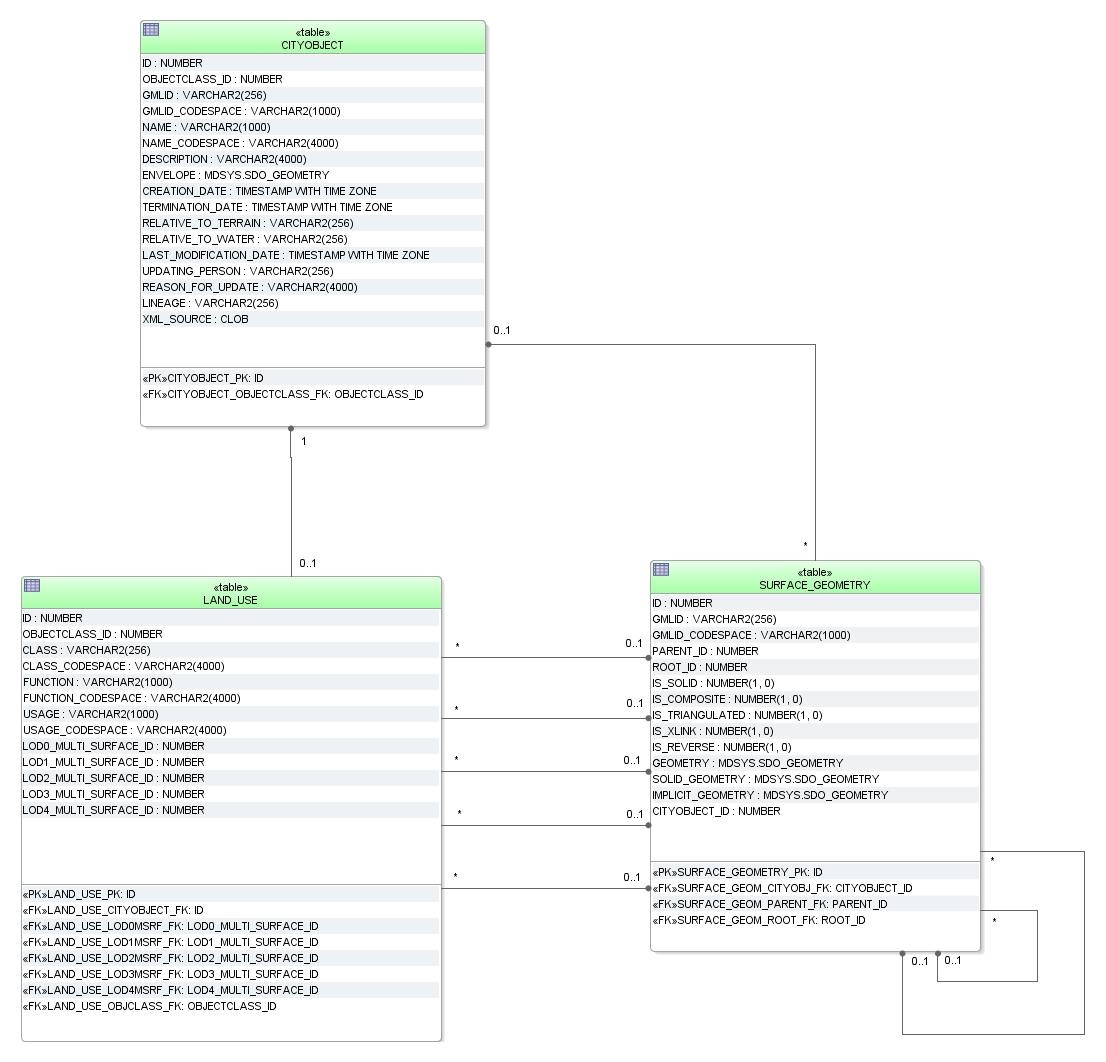
Fig. 2.49 LandUse database schema