3.1.9. LandUse model
LandUse objects describe areas of the earth’s surface dedicated to a specific land use. They can be employed to represent parcels in 3D. Fig. 3.15 shows the UML diagram of land use objects.
Every LandUse object may have the attributes class (e.g. settlement area, industrial area, farmland etc.), function (purpose, e.g. cornfield), and usage which can be used, if the way the object is actually used differs from the function. Since the attributes usage and function may be used multiple times, storing them in only one string requires a single white space as unique separatorRelational database schema.
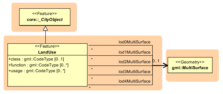
Fig. 3.15 LandUse model
The LandUse object is defined for all LoD 0-4 and may have different geometries for each LoD. The surface geometry of a LandUse object is required to have 3D coordinate values. It must be a GML3 MultiSurface, which might be assigned appearance properties like material (X3DMaterial) and texture (_AbstractTexture and its subclasses).