4.6.5. Bounding box filter
The bounding box filter takes a 2D bounding box as parameter that is given by the coordinate values of its lower left (xmin, ymin) and upper right (xmax, ymax) corner. It is evaluated against the ENVELOPE column of the CITYOBJECT table.
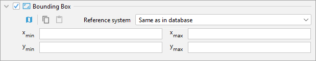
Fig. 4.58 Bounding box filter for visualization export operations.
Only top-level features whose center point of their envelope is either inside or on the left or top border of the provided bounding box will be exported.
Similar to the CityGML/CityJSON export operation, the coordinate values of the bounding box filter
can either be entered manually or chosen interactively in a 2D map window.
To open the map window, click on the map button  .
A comprehensive guide on how to use the map window is provided in chapter
Section 4.8.
.
A comprehensive guide on how to use the map window is provided in chapter
Section 4.8.
Note
When choosing a spatial bounding filter, make sure that spatial indexes are enabled (use the index operation on the Database tab to check the status of indexes, cf. Section 4.3.3).
Note
If the entire 3D city model stored in the 3DCityDB instance shall be exported with tiling enabled, then a bounding box spanning the overall area of the model must be provided. This bounding box can be easily calculated on the Database tab (cf. Section 4.3.2).